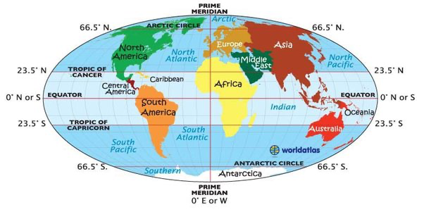
Continent map with latitude and longitude From KATRINA AXFORD
Tropics area
The tropics are defined as all areas located between 23.4 degrees north and south latitude because they are exposed to direct radiation from the sun for part of the year.
The tropics include the Equator and parts of North America, South America, Africa, Asia, and Australia.
The tropics account for 36 percent of Earth's landmass and are home to about a third of the world's people.
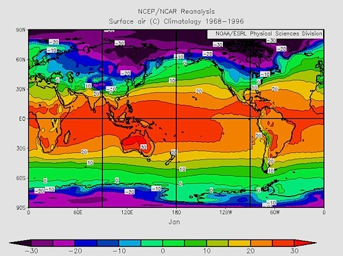
Global temperature map From Climate Reanalyzer
Consistent warmth and very small day-to-day temperature fluctuations
Temperature is averaging 25 to 28 degrees Celsius (77 to 82 degrees Fahrenheit).This is because the tropics get more exposure to the sun.
A small annual range of temperature
Near the Equator, the difference in mean temperature between the warmest and coldest months is rarely more than 4°C, and at some locations it is less than 1°C.
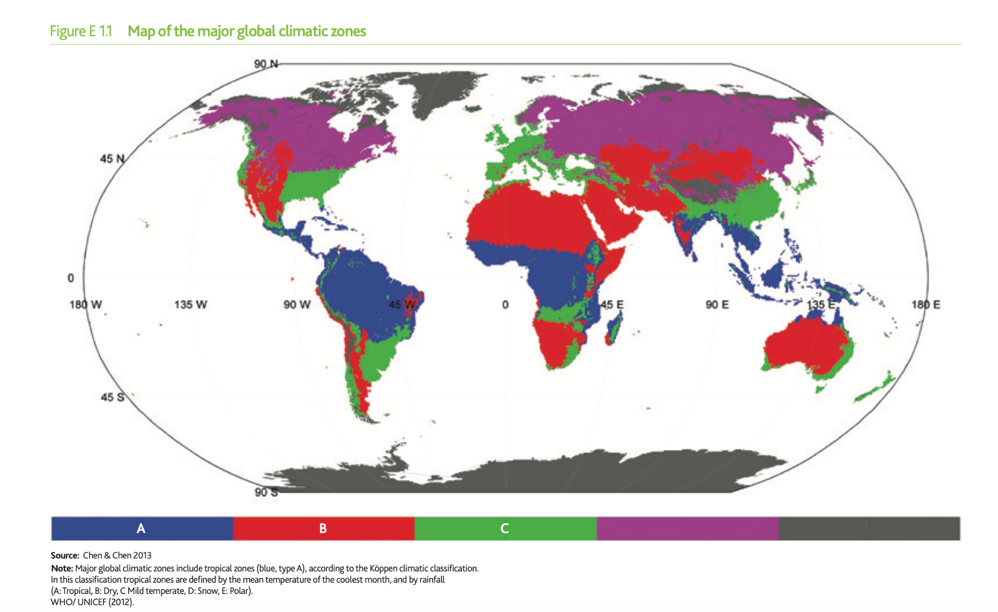
Climate
Climate maps (click on a region to show its average temperature, climate name, and major vegetation).
Tropical savanna climate
Wet and dry season The wet season becomes shorter with increasing latitude before it disappears altogether as one moves into the arid zone near the Tropics. Region: West and central Africa north of the Equator, and in the Indonesian/Australian region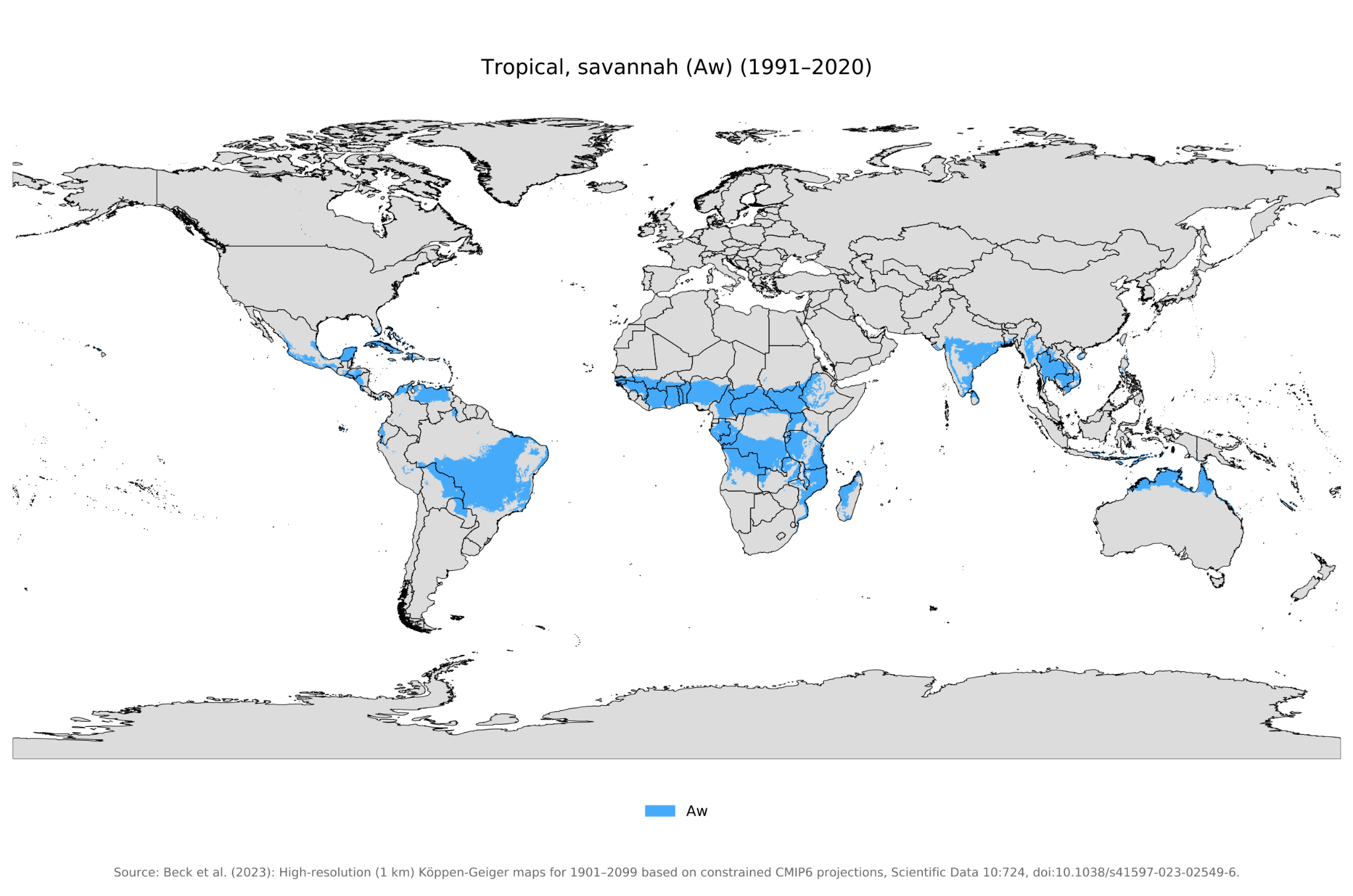
Tropical savanna zone map From Sky Brary
Tropical monsoon climate
Rainy(March-May and October- November) and dry season Strong seasonal variations of rainfall Region: southern and southeastern Asia
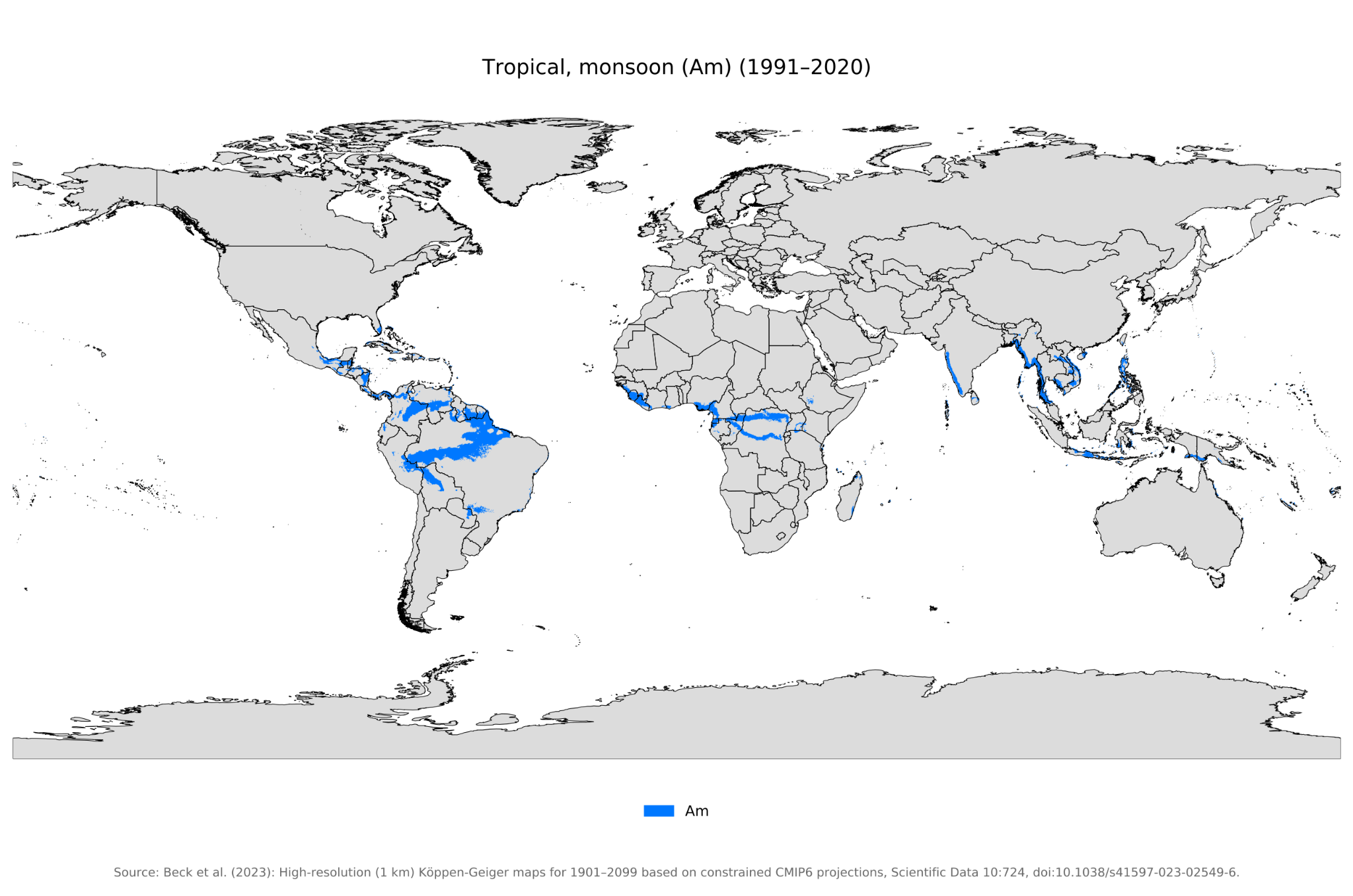
Tropical monsoon zone map From Wilipedia
Tropical Rainforest Climate
Hot, very humid, and wet with no dry season Region: Southeastern Asia, North of South American, Middle of Africa
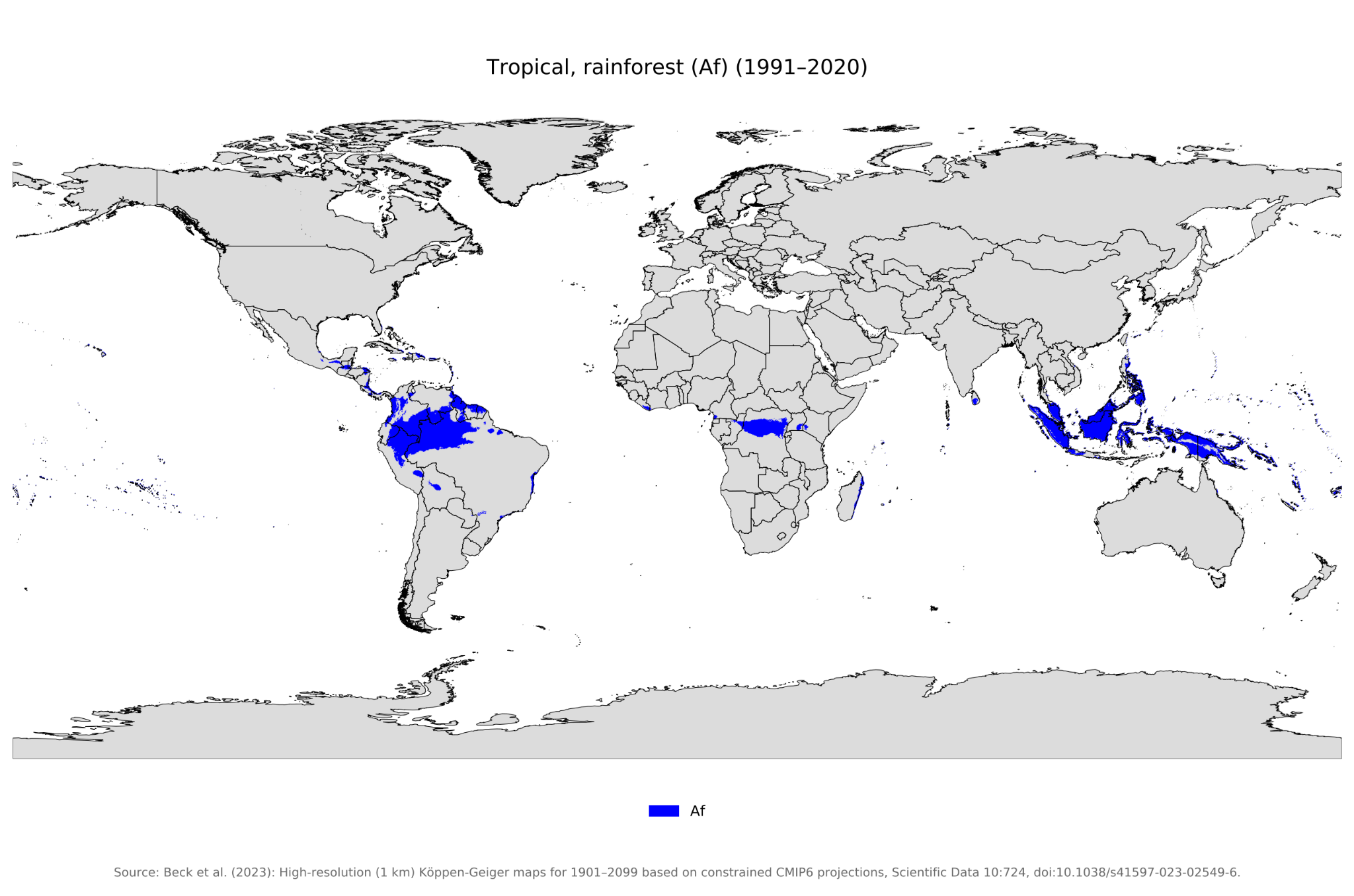
Tropical rainforest zone map From Wilipedia
Tropical Desert Climate
Very hot. Summer day time temperatures can exceed 40°C, at night the temperature can drop below 0°C. Very dry with less than 250 mm of rainfall a year. Region: between 15 and 30 degrees latitude North of Africa, West and middle of Australia
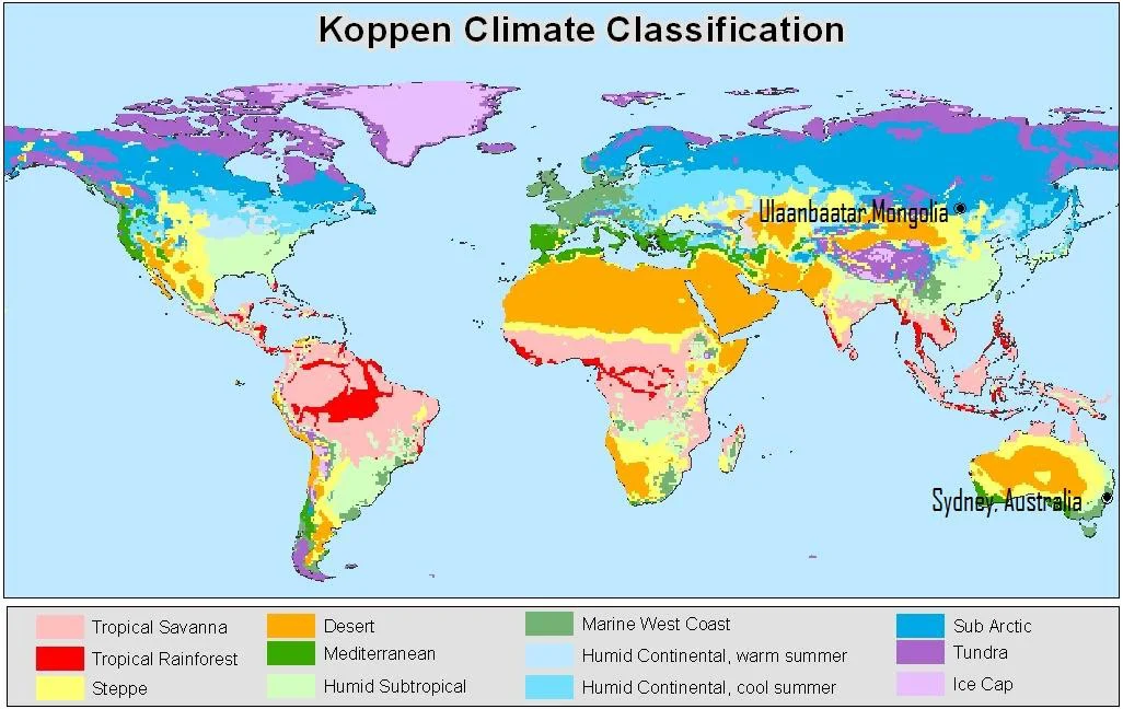
World Climate Zones From Rahul sir’s ias academy
by Wei Siyu